
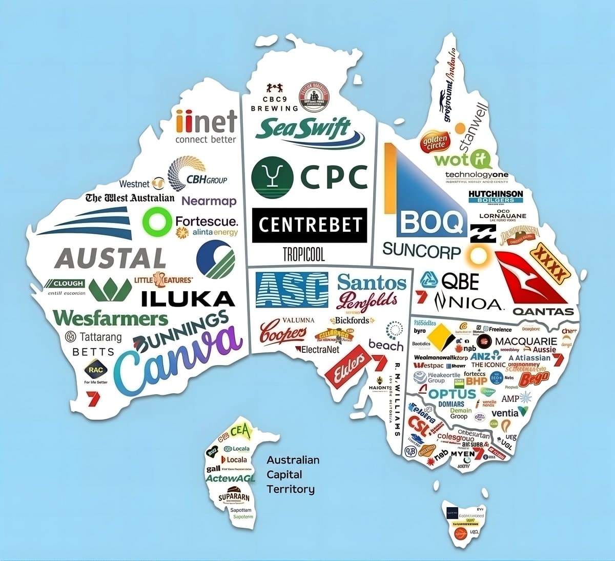
@scarlett_sQantas, Nearmap and Canva headline the main companies of Australia #QantasAirways
Ver publicación original@scarlett_sQantas, Nearmap and Canva headline the main companies of Australia #QantasAirways
Ver publicación originalFoto de @scarlett_s· Aug 23, 2026· Qantas Airways
The image is a stylized map of Australia covered in logos of various Australian companies. The logos are placed geographically across the map, indicating the presence or origin of these businesses. The overall mood is informative and promotional, showcasing a wide range of industries. A notable detail is the prominent placement of the Qantas logo on the eastern coast. ON-SCREEN TEXT: iiNet, connect better, Westnet, The West Australian, Nearmap, Fortescue. alintaenergy, CBHGROUP, CPC, CENTREBET, TROPICOOL, SeaSwift, CBC9 BREWING, AUSTAL, CLOUGH, entill escorian, LITTLE CREATURES, ILUKA, Wesfarmers, Tattarang, BETTS, RAC, For Life Better, BUNNINGS, Canva, ASC, Santos, Penfolds, Valumna, Bickfords, ElectraNet, Coopers, beach, R. W. WILLIAMS, HAIONTS, CEA, Locala, gall, ActewAGL, SUPARARN, Sapoterm, Australian Capital Territory, golden circle, wot
Ver todas las fotos de Qantas AirwaysLeer la wiki de Qantas Airways
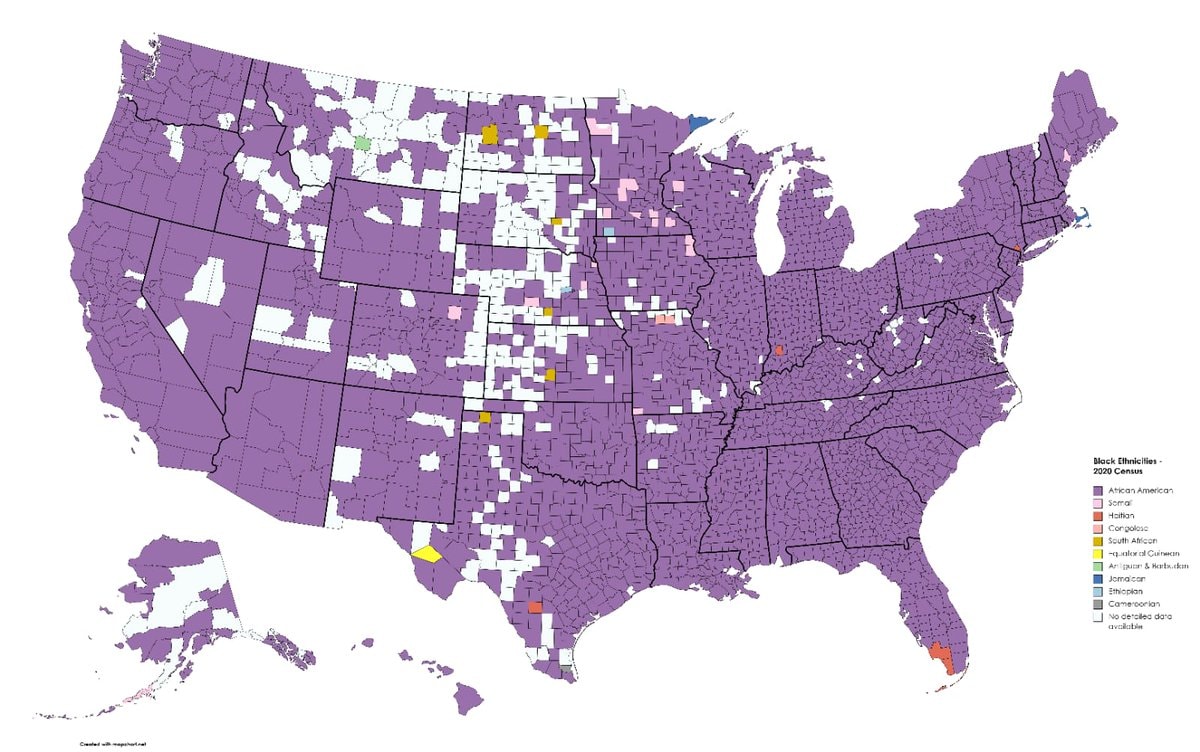 Black ethnicity by US county
 2His & Hers Netflix ranking 2026
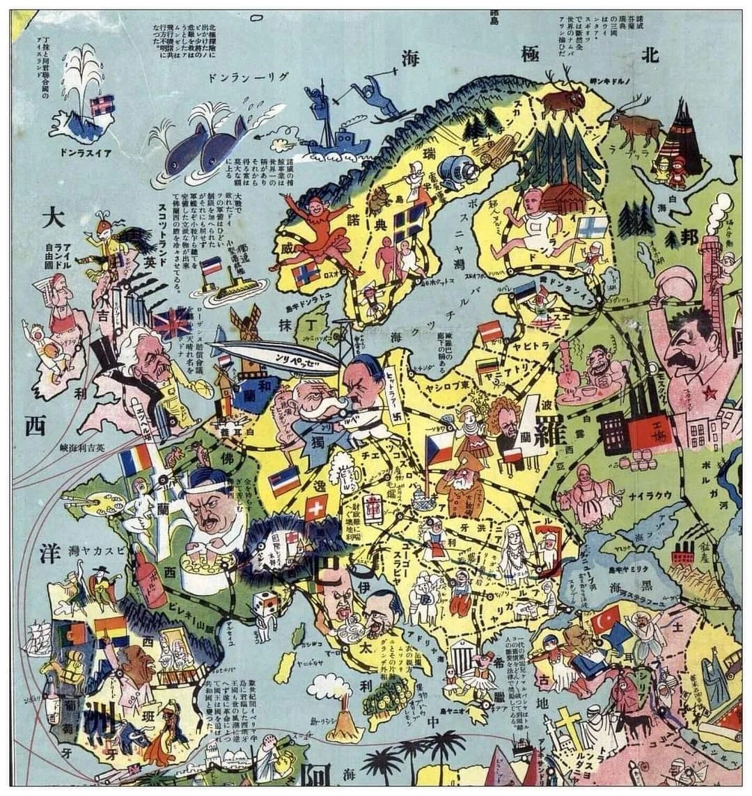 1932 Japanese map of Europe
 white ethnic groups by U.S. county
 India 1525 historical map
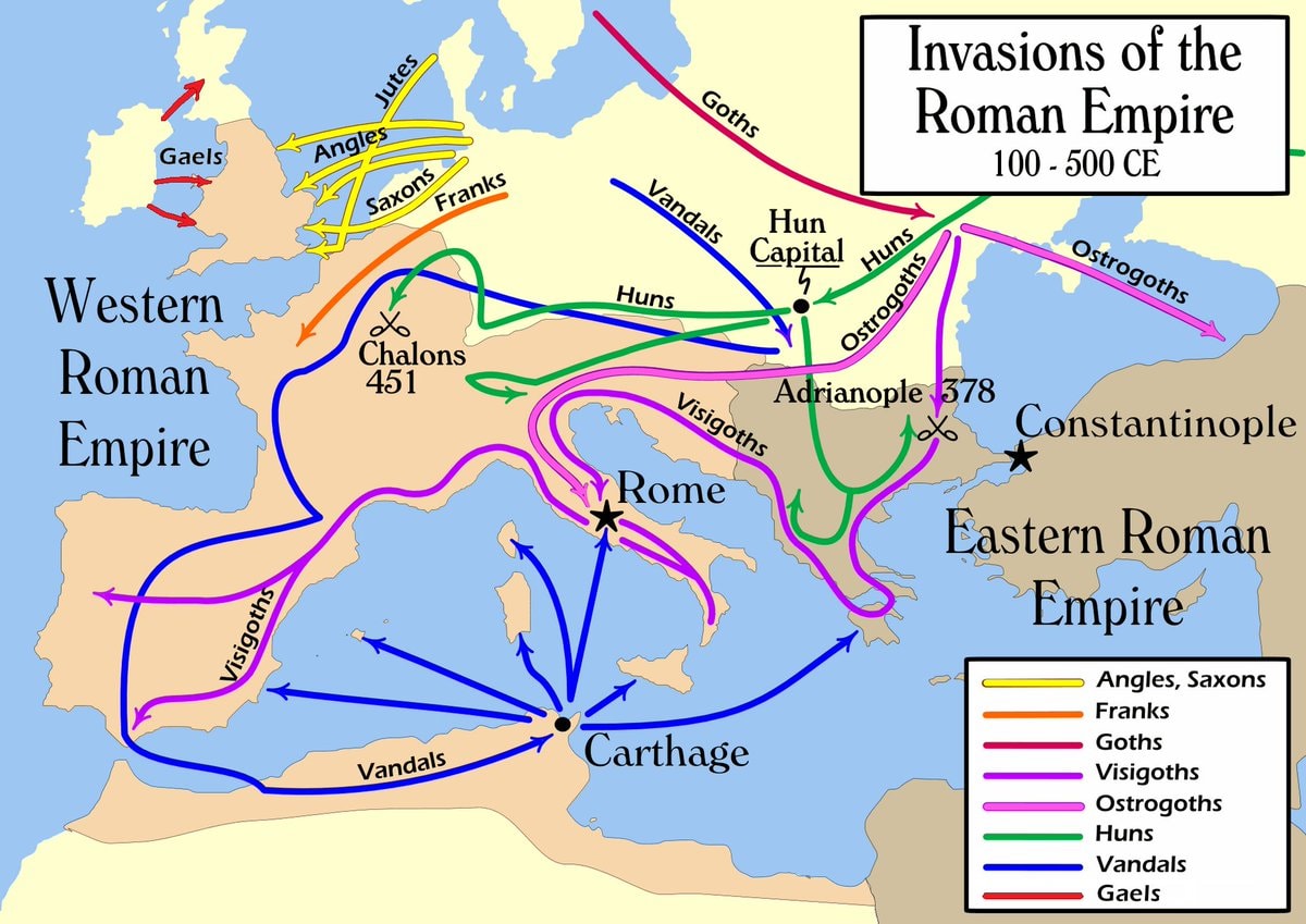 Invasions of the Roman Empire 100–500 CE
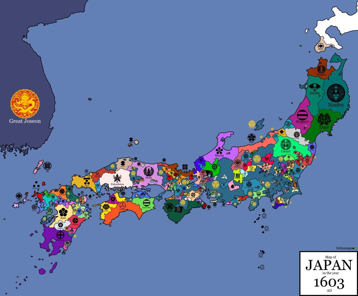 Japan 1603 map
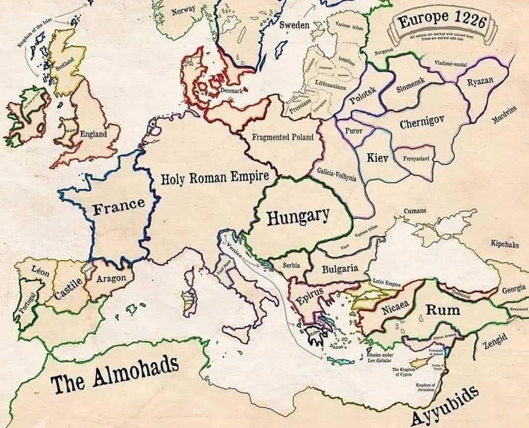 Europe in 1226
 most common US road suffixes by county
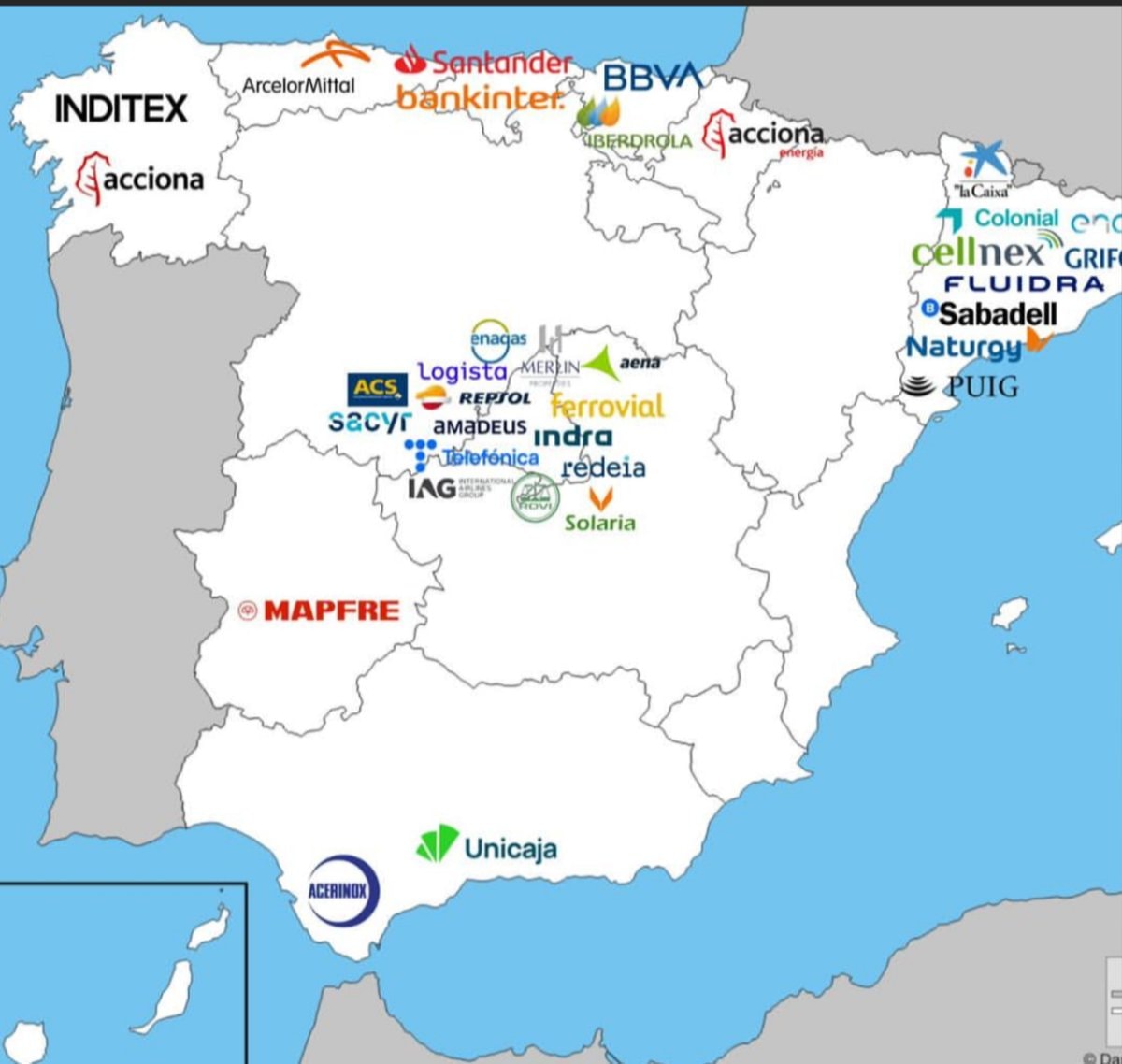 Major companies based in Spain
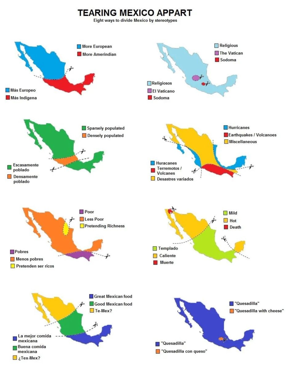 8 ways to divide Mexico by stereotype
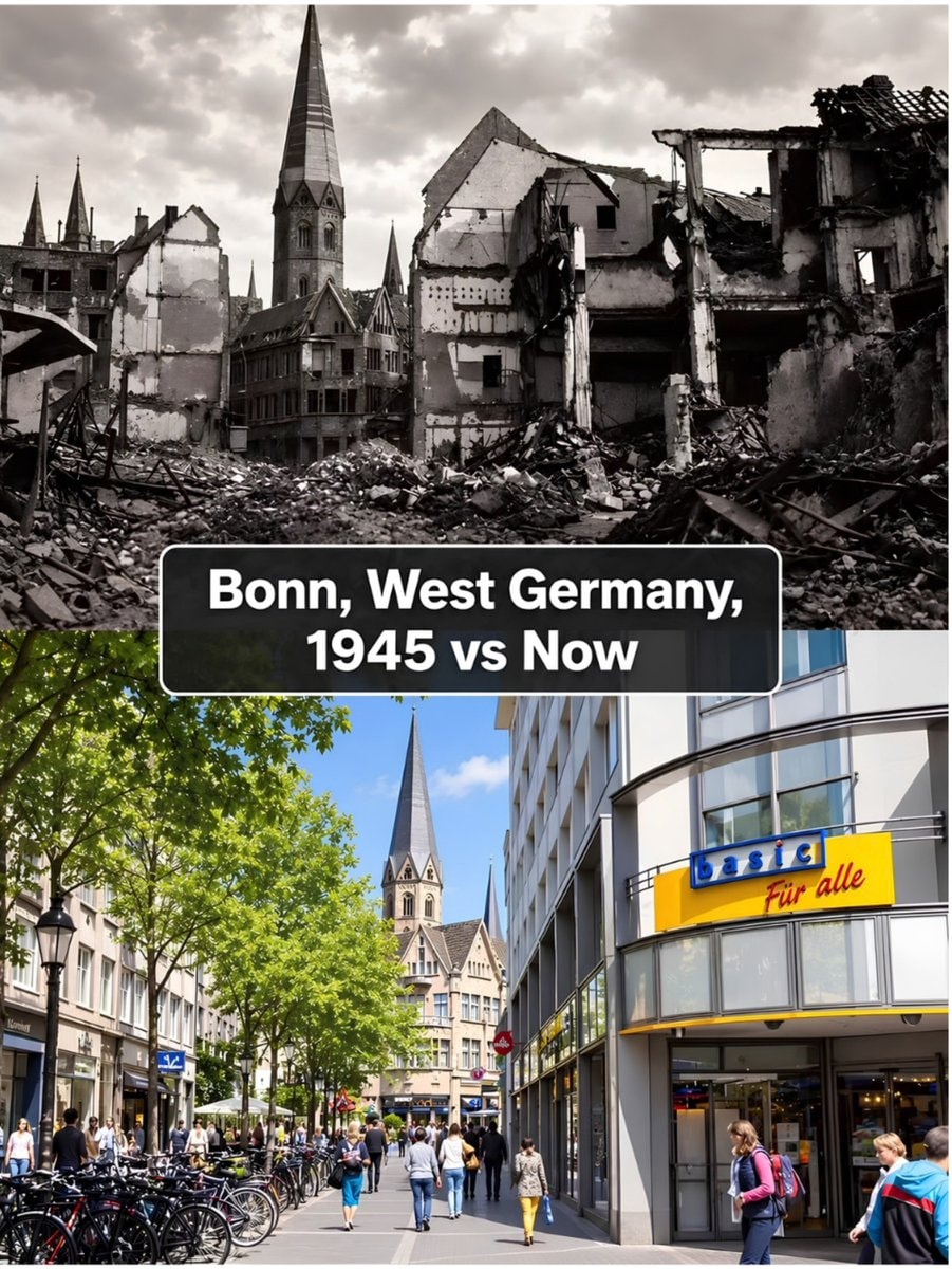 Bonn 1945 vs present day comparison
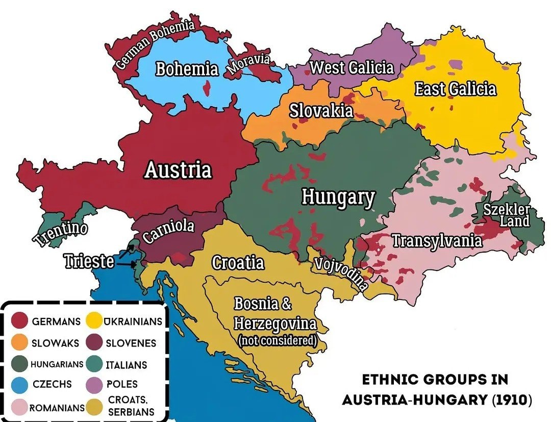 Austria-Hungary ethnic map 1910
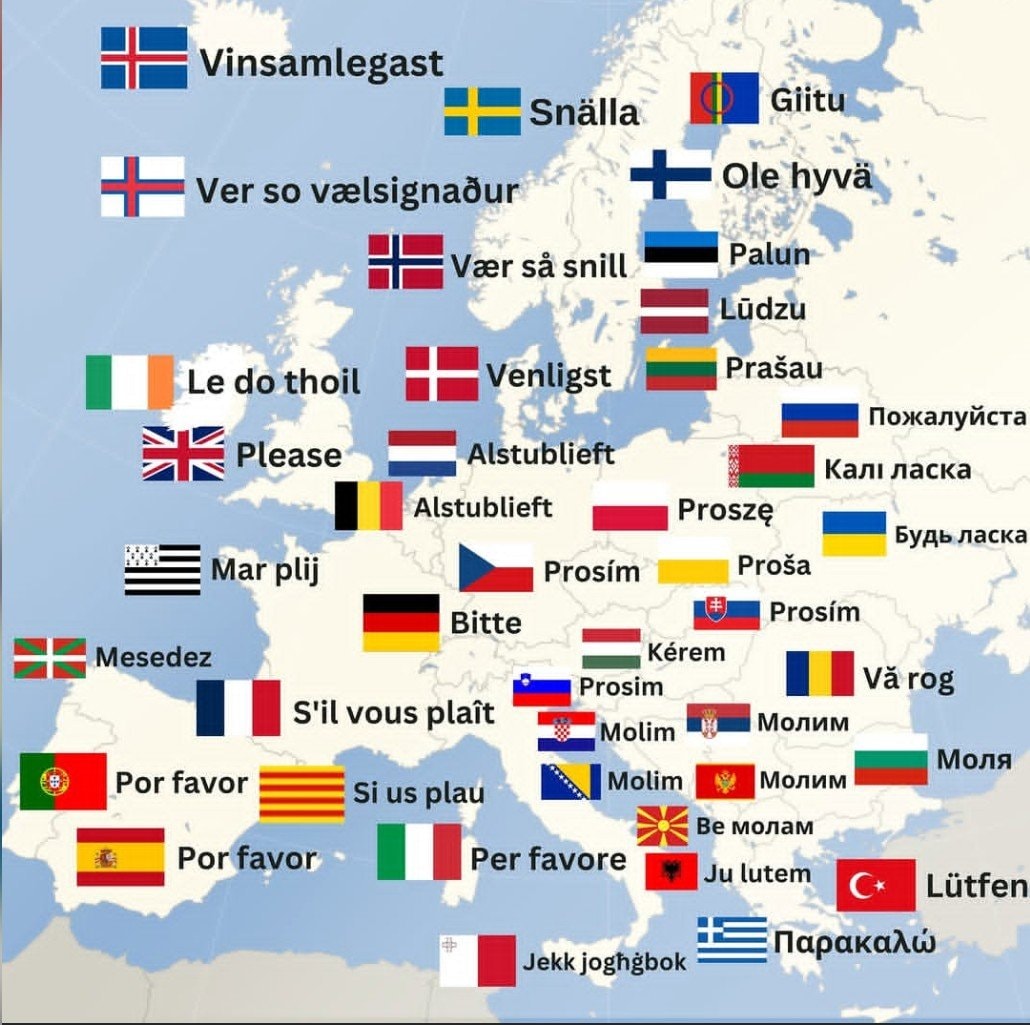 How to say Please in Europe
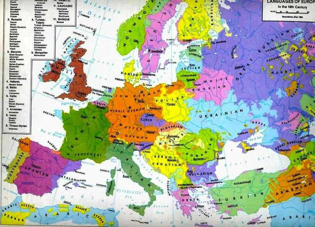 Languages of Europe map after 1882
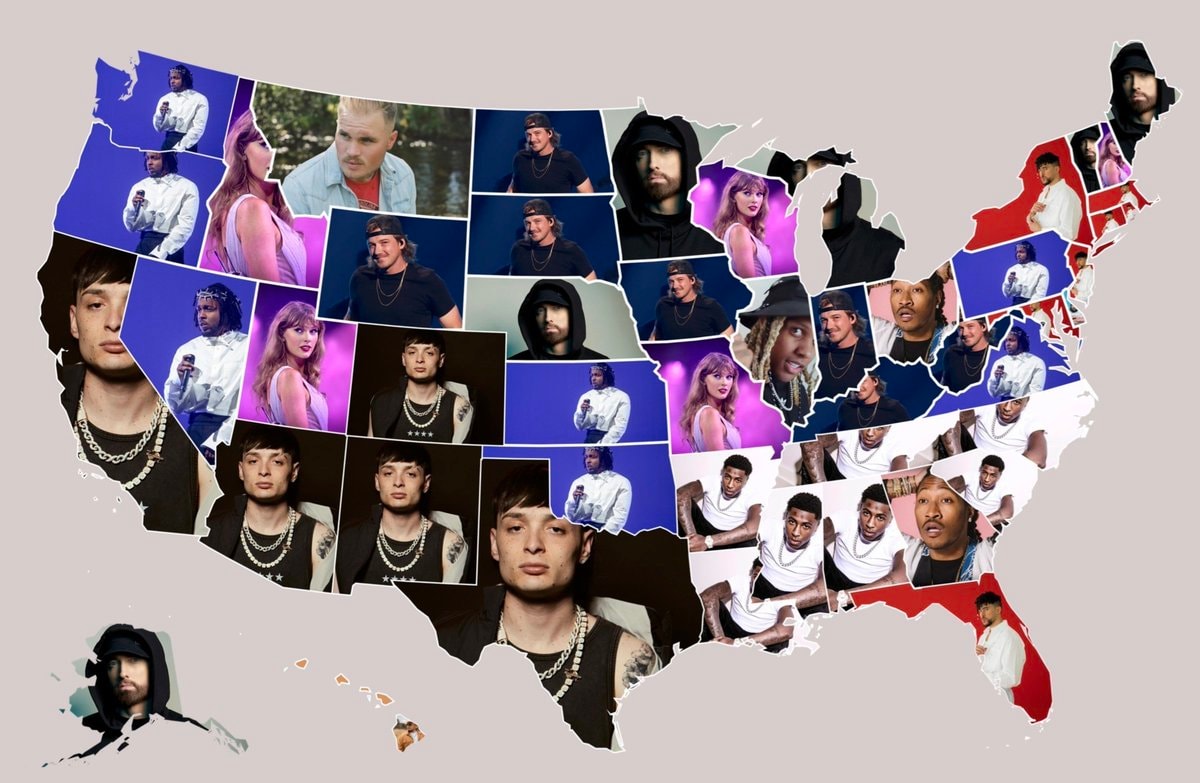 Most streamed artists by U.S. state
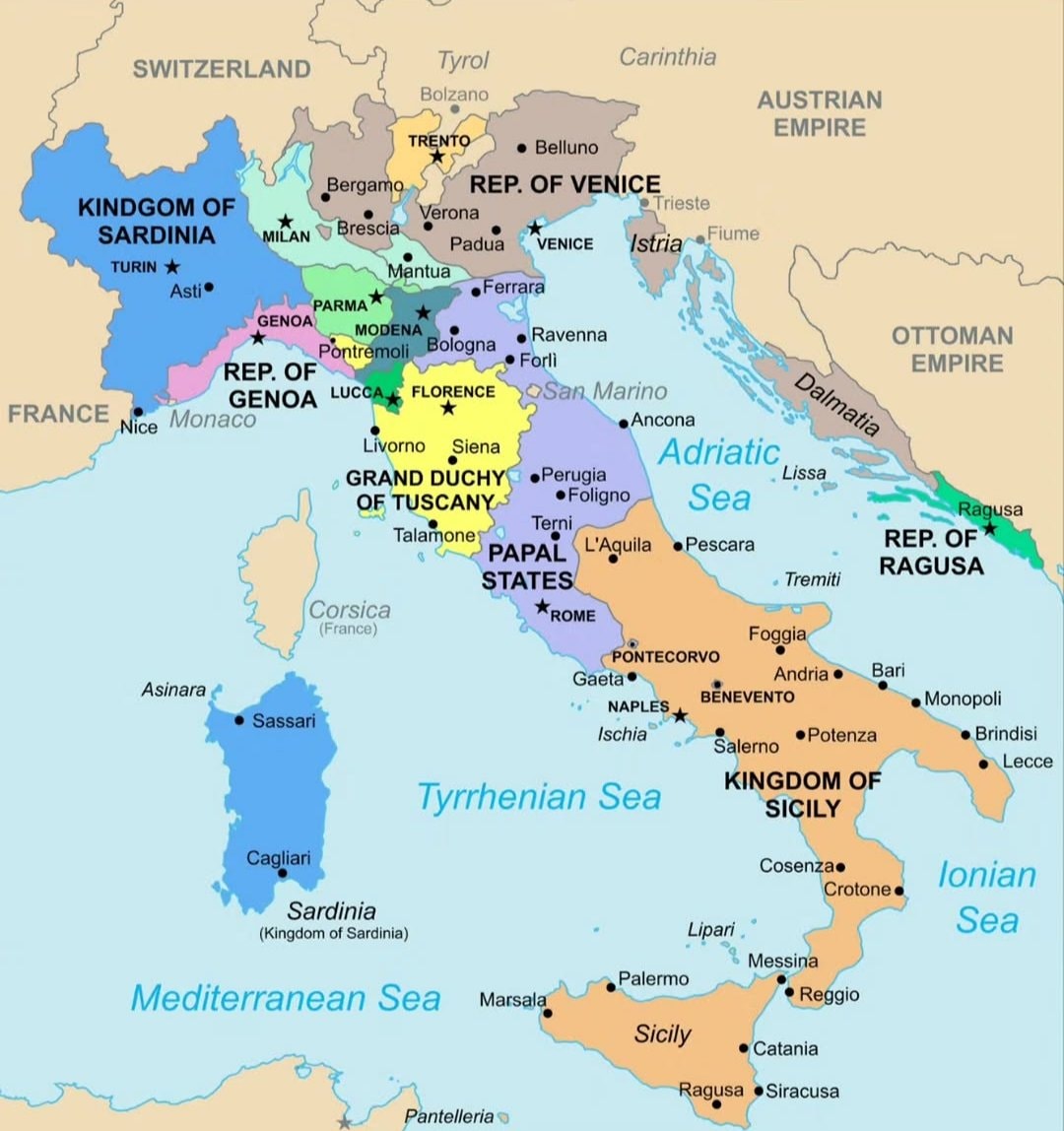 Italy map 1796
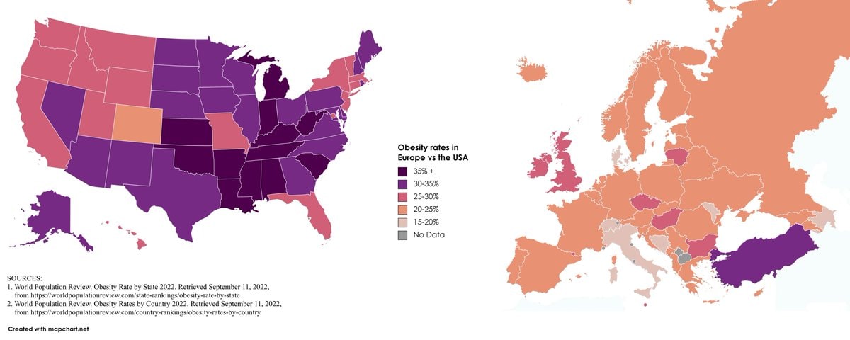 Europe vs USA obesity rates
@scarlett_sQantas, Nearmap and Canva headline the main companies of Australia #QantasAirways
Ver publicación originalFoto de @scarlett_s· Aug 23, 2026· Qantas Airways
The image is a stylized map of Australia covered in logos of various Australian companies. The logos are placed geographically across the map, indicating the presence or origin of these businesses. The overall mood is informative and promotional, showcasing a wide range of industries. A notable detail is the prominent placement of the Qantas logo on the eastern coast. ON-SCREEN TEXT: iiNet, connect better, Westnet, The West Australian, Nearmap, Fortescue. alintaenergy, CBHGROUP, CPC, CENTREBET, TROPICOOL, SeaSwift, CBC9 BREWING, AUSTAL, CLOUGH, entill escorian, LITTLE CREATURES, ILUKA, Wesfarmers, Tattarang, BETTS, RAC, For Life Better, BUNNINGS, Canva, ASC, Santos, Penfolds, Valumna, Bickfords, ElectraNet, Coopers, beach, R. W. WILLIAMS, HAIONTS, CEA, Locala, gall, ActewAGL, SUPARARN, Sapoterm, Australian Capital Territory, golden circle, wot
Ver todas las fotos de Qantas AirwaysLeer la wiki de Qantas Airways
Aún no hay comentarios. ¡Sé el primero!
Black ethnicity by US county2His & Hers Netflix ranking 20261932 Japanese map of Europewhite ethnic groups by U.S. countyIndia 1525 historical mapInvasions of the Roman Empire 100–500 CEJapan 1603 mapEurope in 1226most common US road suffixes by countyMajor companies based in Spain8 ways to divide Mexico by stereotypeBonn 1945 vs present day comparisonAustria-Hungary ethnic map 1910How to say Please in EuropeLanguages of Europe map after 1882Most streamed artists by U.S. stateItaly map 1796Europe vs USA obesity rates
Aún no hay comentarios. ¡Sé el primero!