
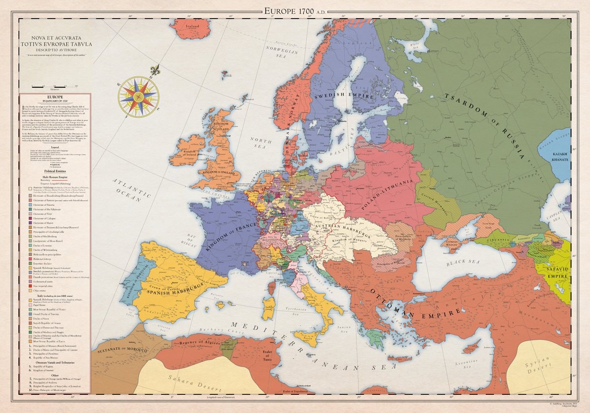
@scarlett_sA whole different map back then, Europe was something else in 1700
Ver publicación original@scarlett_sA whole different map back then, Europe was something else in 1700
Ver publicación originalFoto de @scarlett_s· Aug 30, 2026· News
The image is a historical map of Europe in 1700 AD. It displays political boundaries and territories with various colors representing different empires and kingdoms. The map has a vintage aesthetic with a compass rose and a detailed legend. A notable detail is the extensive coloring of the Holy Roman Empire into many smaller states. ON-SCREEN TEXT: EUROPE 1700 A.D. NOVA ET ACCVRATA TOTIVS EVROPAE TABVLA DESCRIPTIO AVTHORE "A new and accurate map of all Europe. Description of the author." Legend Political Entities Holy Roman Empire Boundary Additional (Habsburgs, Electors, etc.) Electorate of Bavaria Electorate of Cologne Electorate of Mainz Electorate of Trier Electorate of Saxony Electorate of Brandenburg Electorate of the Palatinate Duchy of Bavaria Duchy of Saxe-Lauenburg (Saxony) Duchy of Saxe-Gotha Duchy of Saxe-Meiningen Duchy of Saxe-Weimar Principality of Ansbach Princip
 2Benedict Cumberbatch on climate and populism
 2EU directive on green claims
 2Thomas Matthew Crooks cremation details
 2Thomas Matthew Crooks cremation donor
 3China mothership for giant submarine drones
 2Bleach September 19 announcement
 2US Space Force orbital weapons
 2Rep. Nancy Mace calls for execution
 Rep. Ilhan Omar speaks
 Confused reaction post
 Congolese National Police in Kisangani
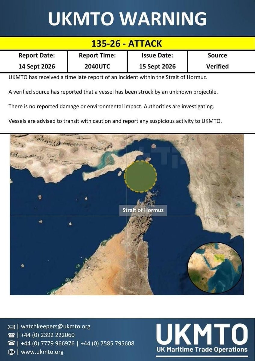 ship struck missile Strait of Hormuz
 3IDF Northern Command on Hezbollah regrouping
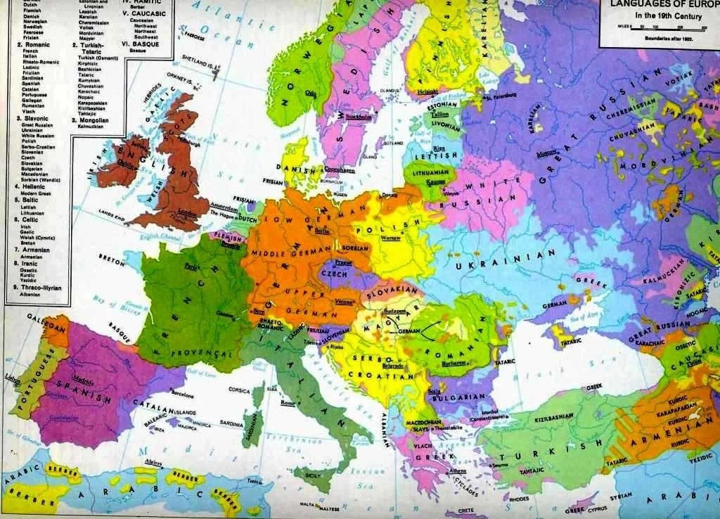 Languages of Europe map after 1882
 Tom Holland Spider-Man vs Medieval Role
 2NAZA documentary controversy
 2Amazon workers food stamps profit gap
 Lil Durk October trial judge Michael Fitzgerald
@scarlett_sA whole different map back then, Europe was something else in 1700
Ver publicación originalFoto de @scarlett_s· Aug 30, 2026· News
The image is a historical map of Europe in 1700 AD. It displays political boundaries and territories with various colors representing different empires and kingdoms. The map has a vintage aesthetic with a compass rose and a detailed legend. A notable detail is the extensive coloring of the Holy Roman Empire into many smaller states. ON-SCREEN TEXT: EUROPE 1700 A.D. NOVA ET ACCVRATA TOTIVS EVROPAE TABVLA DESCRIPTIO AVTHORE "A new and accurate map of all Europe. Description of the author." Legend Political Entities Holy Roman Empire Boundary Additional (Habsburgs, Electors, etc.) Electorate of Bavaria Electorate of Cologne Electorate of Mainz Electorate of Trier Electorate of Saxony Electorate of Brandenburg Electorate of the Palatinate Duchy of Bavaria Duchy of Saxe-Lauenburg (Saxony) Duchy of Saxe-Gotha Duchy of Saxe-Meiningen Duchy of Saxe-Weimar Principality of Ansbach Princip
2Benedict Cumberbatch on climate and populism2EU directive on green claims2Thomas Matthew Crooks cremation details2Thomas Matthew Crooks cremation donor3China mothership for giant submarine drones2Bleach September 19 announcement2US Space Force orbital weapons2Rep. Nancy Mace calls for executionRep. Ilhan Omar speaksConfused reaction postCongolese National Police in Kisanganiship struck missile Strait of Hormuz3IDF Northern Command on Hezbollah regroupingLanguages of Europe map after 1882Tom Holland Spider-Man vs Medieval Role2NAZA documentary controversy2Amazon workers food stamps profit gapLil Durk October trial judge Michael Fitzgerald