
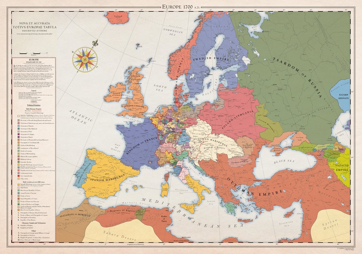
@scarlett_sA whole different map back then, Europe was something else in 1700
Ver publicación original@scarlett_sA whole different map back then, Europe was something else in 1700
Ver publicación originalFoto de @scarlett_s· Aug 30, 2026· News
The image is a historical map of Europe in 1700 AD. It displays political boundaries and territories with various colors representing different empires and kingdoms. The map has a vintage aesthetic with a compass rose and a detailed legend. A notable detail is the extensive coloring of the Holy Roman Empire into many smaller states. ON-SCREEN TEXT: EUROPE 1700 A.D. NOVA ET ACCVRATA TOTIVS EVROPAE TABVLA DESCRIPTIO AVTHORE "A new and accurate map of all Europe. Description of the author." Legend Political Entities Holy Roman Empire Boundary Additional (Habsburgs, Electors, etc.) Electorate of Bavaria Electorate of Cologne Electorate of Mainz Electorate of Trier Electorate of Saxony Electorate of Brandenburg Electorate of the Palatinate Duchy of Bavaria Duchy of Saxe-Lauenburg (Saxony) Duchy of Saxe-Gotha Duchy of Saxe-Meiningen Duchy of Saxe-Weimar Principality of Ansbach Princip
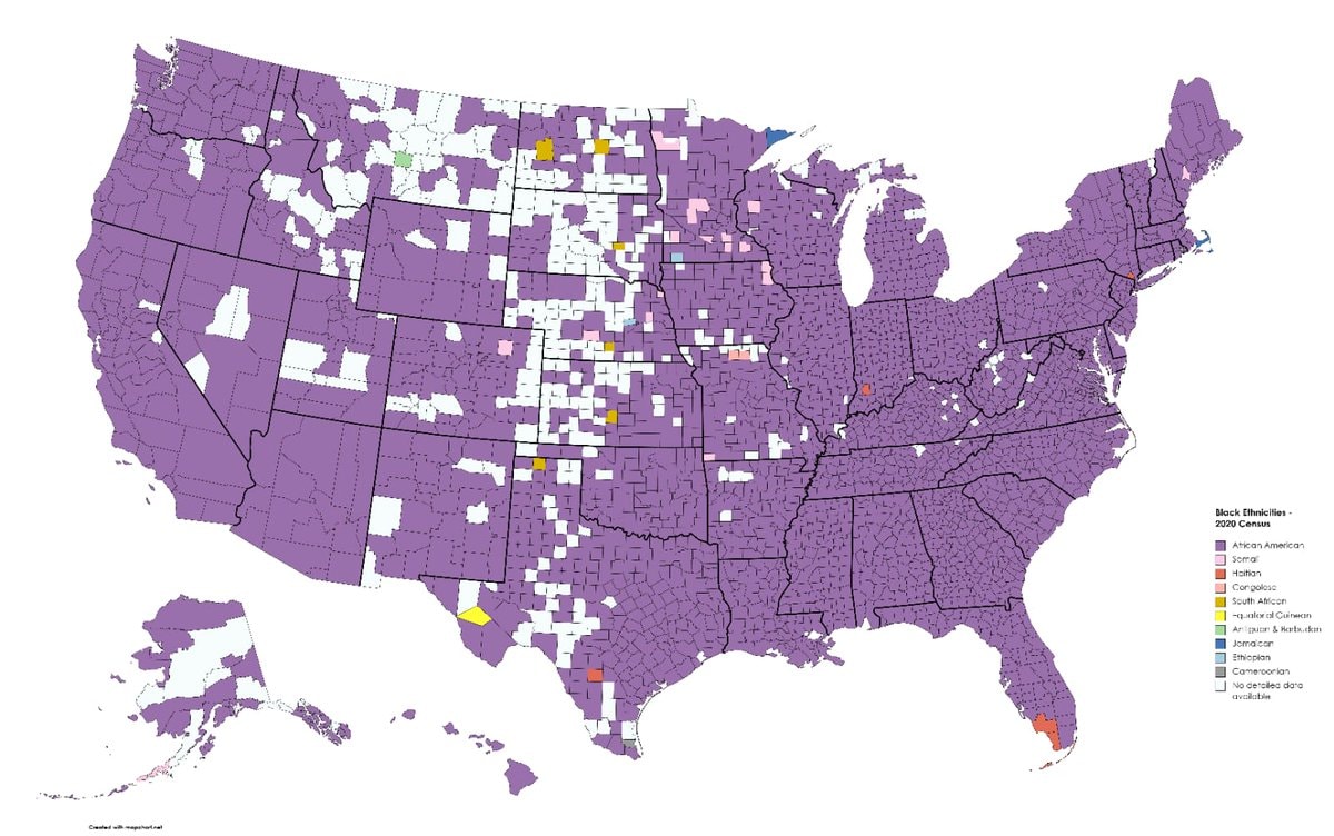 Black ethnicity by US county
 2His & Hers Netflix ranking 2026
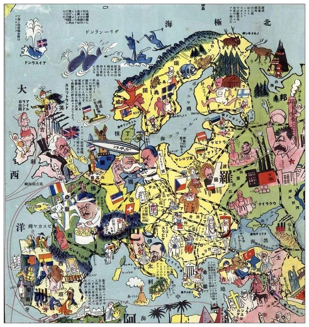 1932 Japanese map of Europe
 white ethnic groups by U.S. county
 India 1525 historical map
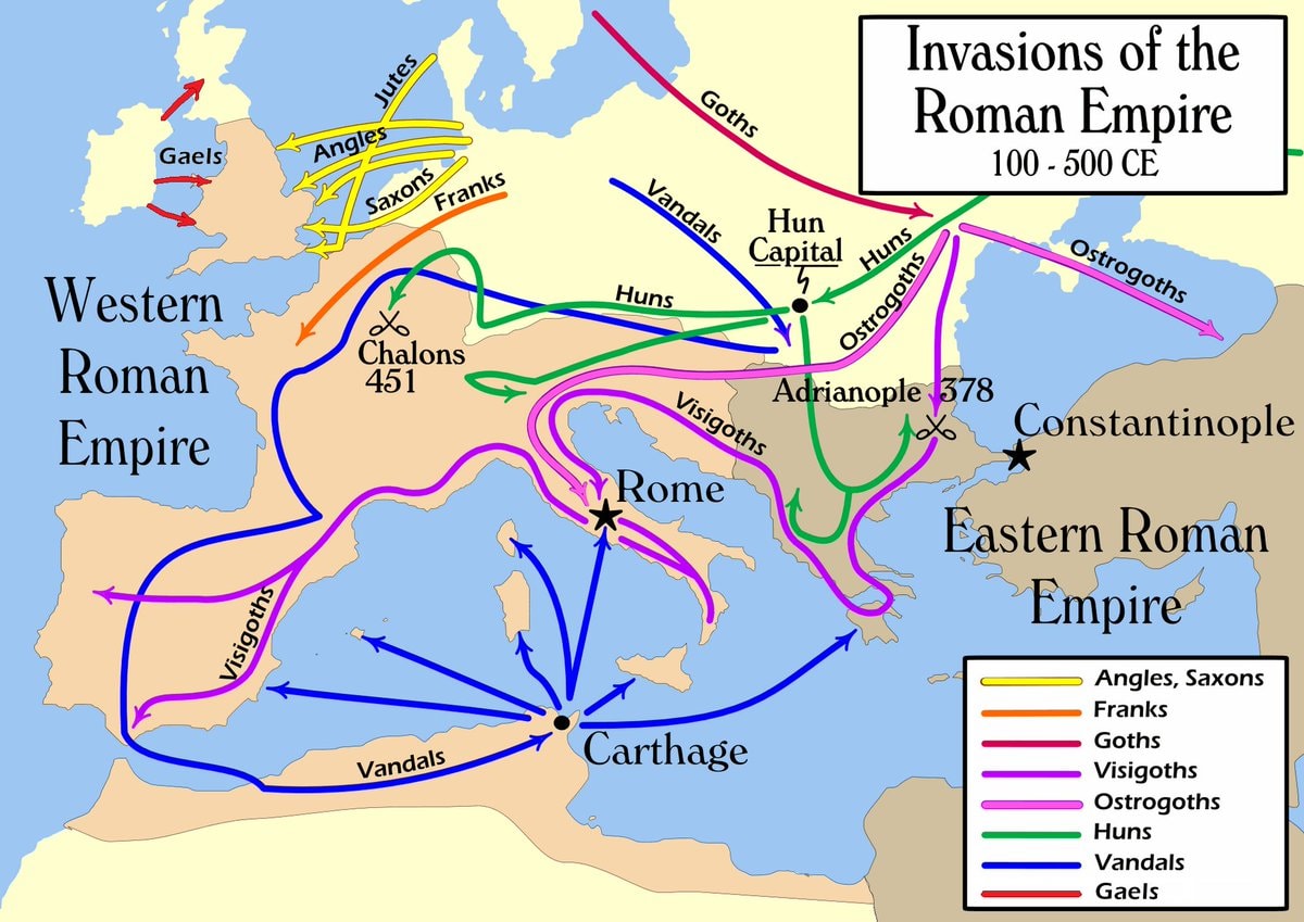 Invasions of the Roman Empire 100–500 CE
 Japan 1603 map
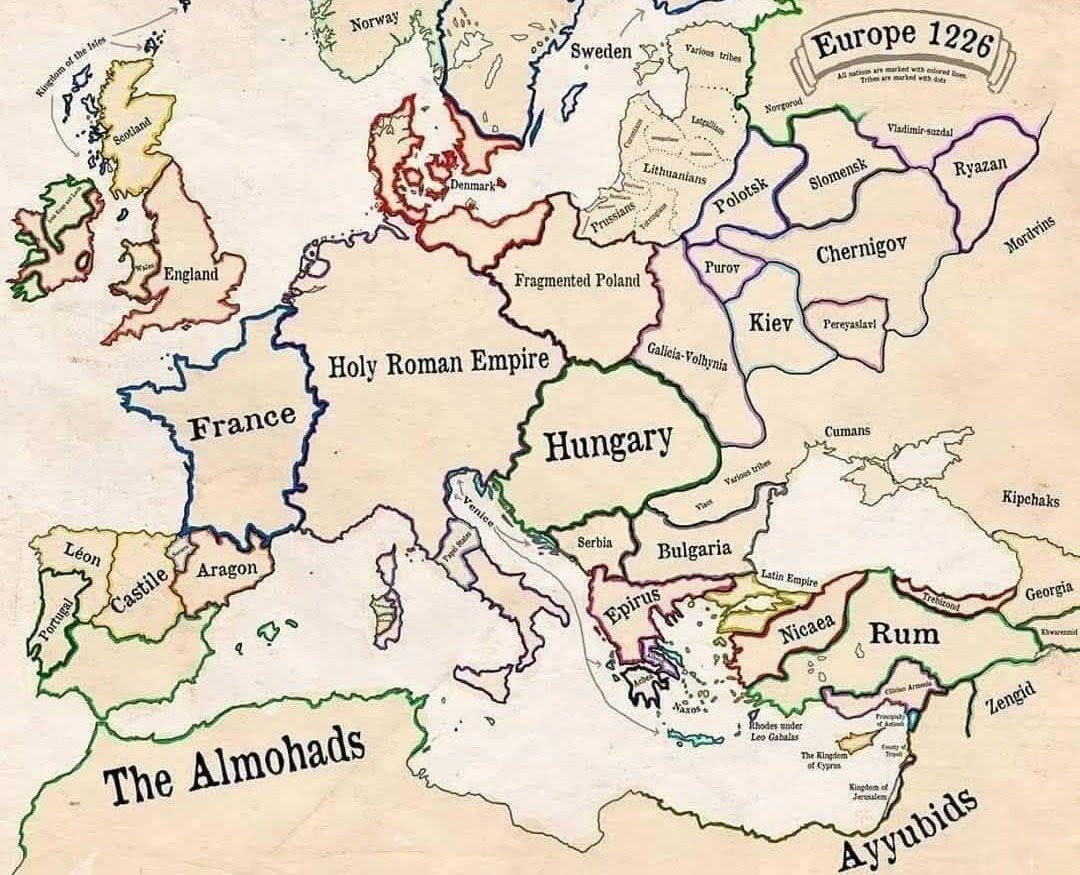 Europe in 1226
 most common US road suffixes by county
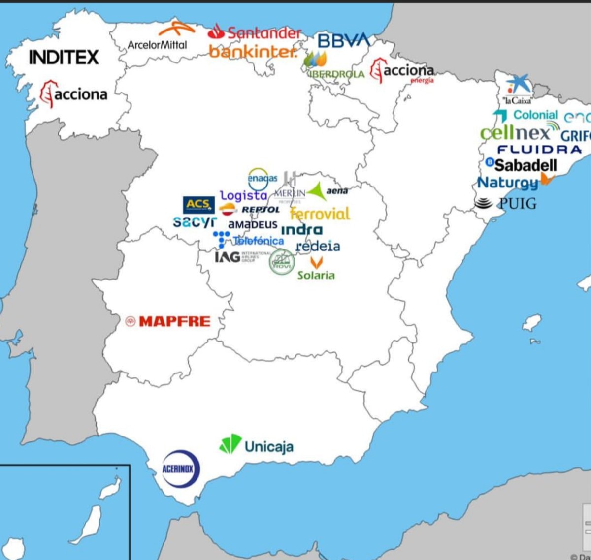 Major companies based in Spain
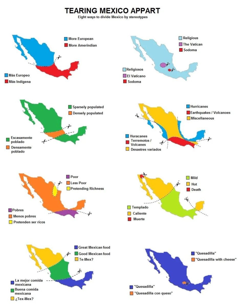 8 ways to divide Mexico by stereotype
 Bonn 1945 vs present day comparison
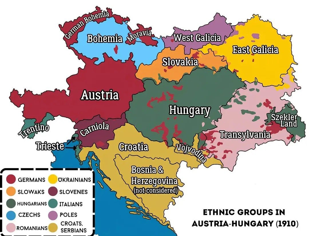 Austria-Hungary ethnic map 1910
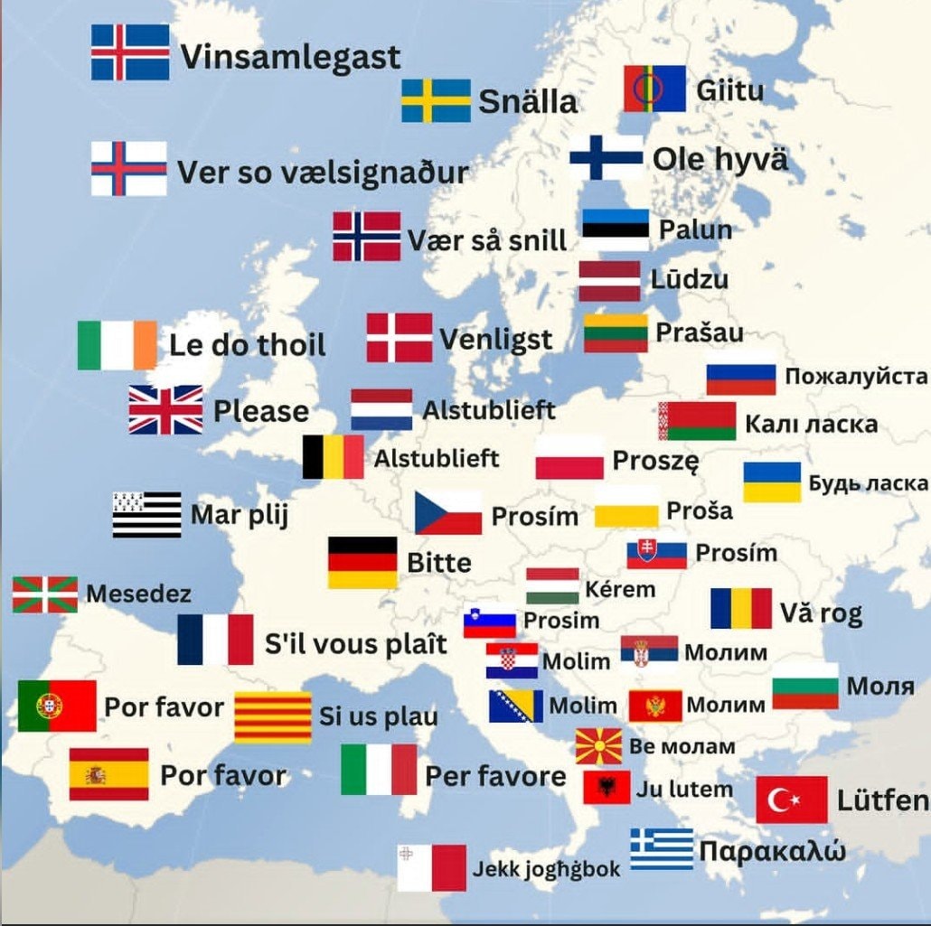 How to say Please in Europe
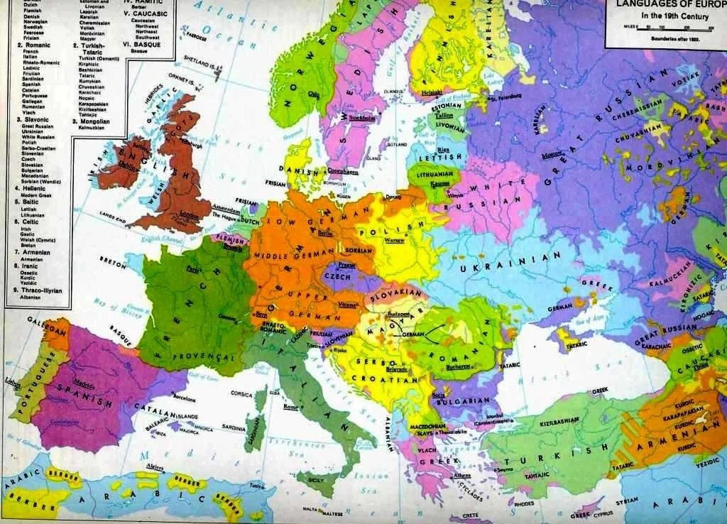 Languages of Europe map after 1882
 Most streamed artists by U.S. state
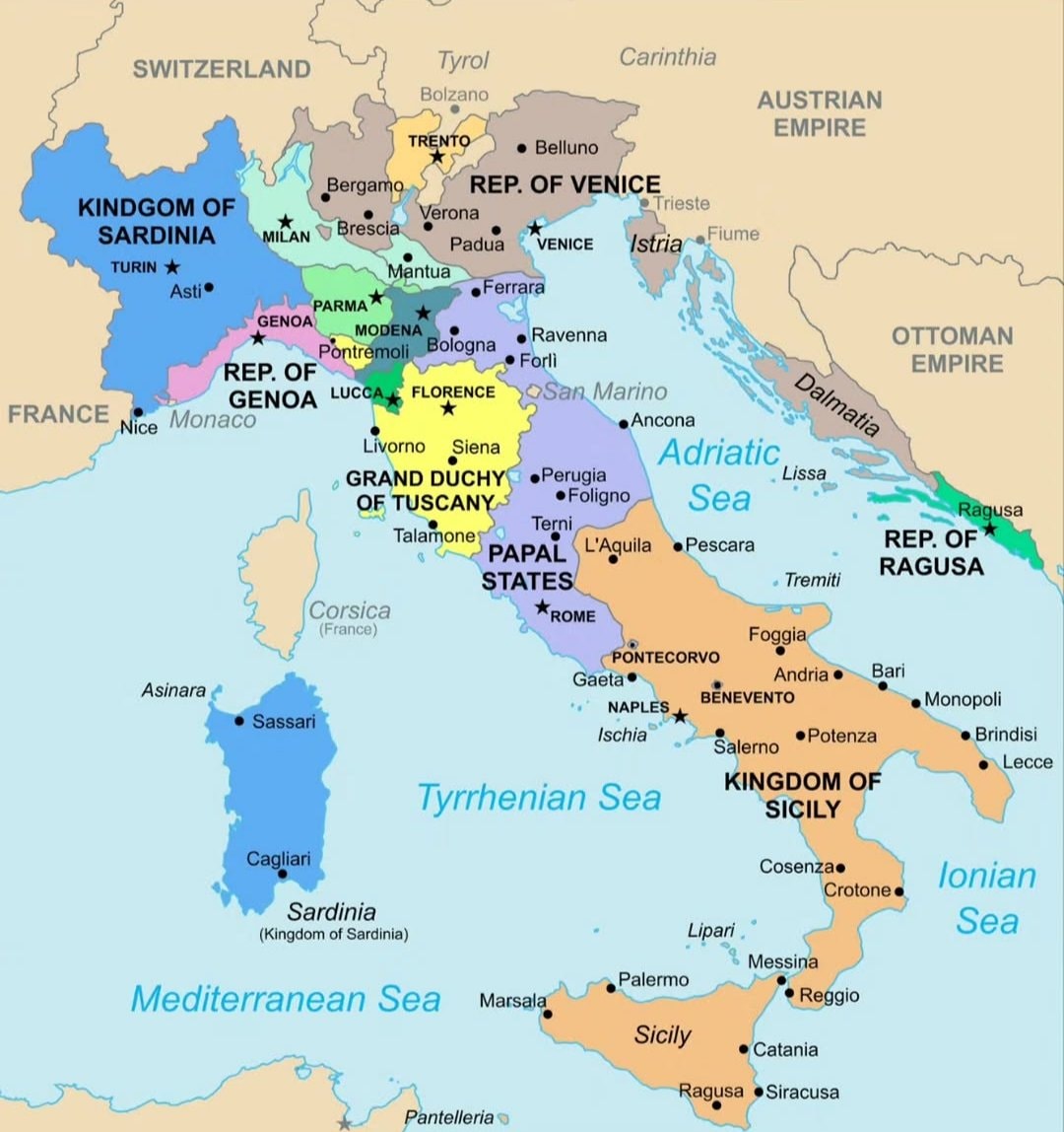 Italy map 1796
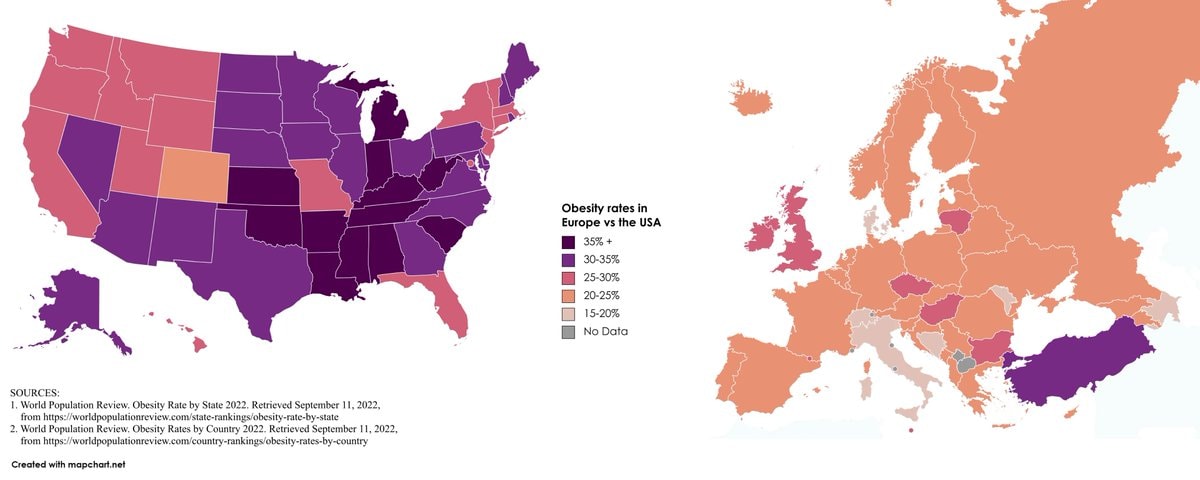 Europe vs USA obesity rates
@scarlett_sA whole different map back then, Europe was something else in 1700
Ver publicación originalFoto de @scarlett_s· Aug 30, 2026· News
The image is a historical map of Europe in 1700 AD. It displays political boundaries and territories with various colors representing different empires and kingdoms. The map has a vintage aesthetic with a compass rose and a detailed legend. A notable detail is the extensive coloring of the Holy Roman Empire into many smaller states. ON-SCREEN TEXT: EUROPE 1700 A.D. NOVA ET ACCVRATA TOTIVS EVROPAE TABVLA DESCRIPTIO AVTHORE "A new and accurate map of all Europe. Description of the author." Legend Political Entities Holy Roman Empire Boundary Additional (Habsburgs, Electors, etc.) Electorate of Bavaria Electorate of Cologne Electorate of Mainz Electorate of Trier Electorate of Saxony Electorate of Brandenburg Electorate of the Palatinate Duchy of Bavaria Duchy of Saxe-Lauenburg (Saxony) Duchy of Saxe-Gotha Duchy of Saxe-Meiningen Duchy of Saxe-Weimar Principality of Ansbach Princip
Black ethnicity by US county2His & Hers Netflix ranking 20261932 Japanese map of Europewhite ethnic groups by U.S. countyIndia 1525 historical mapInvasions of the Roman Empire 100–500 CEJapan 1603 mapEurope in 1226most common US road suffixes by countyMajor companies based in Spain8 ways to divide Mexico by stereotypeBonn 1945 vs present day comparisonAustria-Hungary ethnic map 1910How to say Please in EuropeLanguages of Europe map after 1882Most streamed artists by U.S. stateItaly map 1796Europe vs USA obesity rates