
@taikiThere is a confirmed statistic on the percentage of Americans who rely on automobiles for their commute to work
Ver publicación original@taikiThere is a confirmed statistic on the percentage of Americans who rely on automobiles for their commute to work
Ver publicación originalFoto de @taiki· Sep 2, 2026· United States
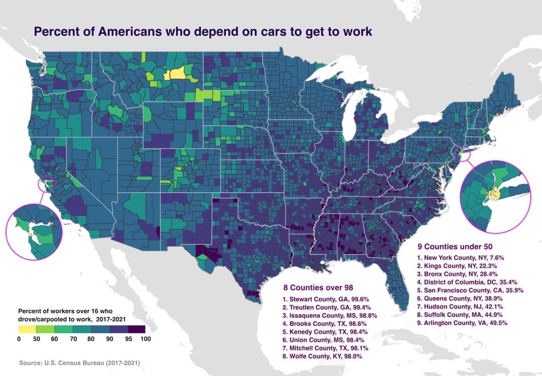
The image is a choropleth map of the United States showing the percent of Americans who depend on cars to get to work. Different colors represent different percentages, with a legend provided at the bottom left. The map highlights specific counties with very high or very low car dependency. The mood is informative and data-driven, with a clean, graphic style. Visually notable are the color gradients and the inset maps zooming in on specific regions like the San Francisco Bay Area and the New York City metropolitan area. ON-SCREEN TEXT: Percent of Americans who depend on cars to get to work Percent of workers over 16 who drove/carpooled to work, 2017-2021 0 50 60 70 80 90 95 100 Source: U.S. Census Bureau (2017-2021) 8 Counties over 98 1. Stewart County, GA, 99.6% 2. Treutlen County, GA,
 Delicate Arch moon frame
 2US gas station price signs hitting $9.999 limit
 Black ethnicity by US county
 China US Treasury holdings 18-year low
 Black Population US 1900 vs 2020
 Trump AI Force emblem
 white ethnic groups by U.S. county
 2Trump serious expression
 Trump announces AI Force
 2Trump on midterm election outcomes
 Donald Trump Greenland Deal
 1972 US presidential election map
 2Toys R Us store expansion
 2US Republicans foreign piracy site ban bill
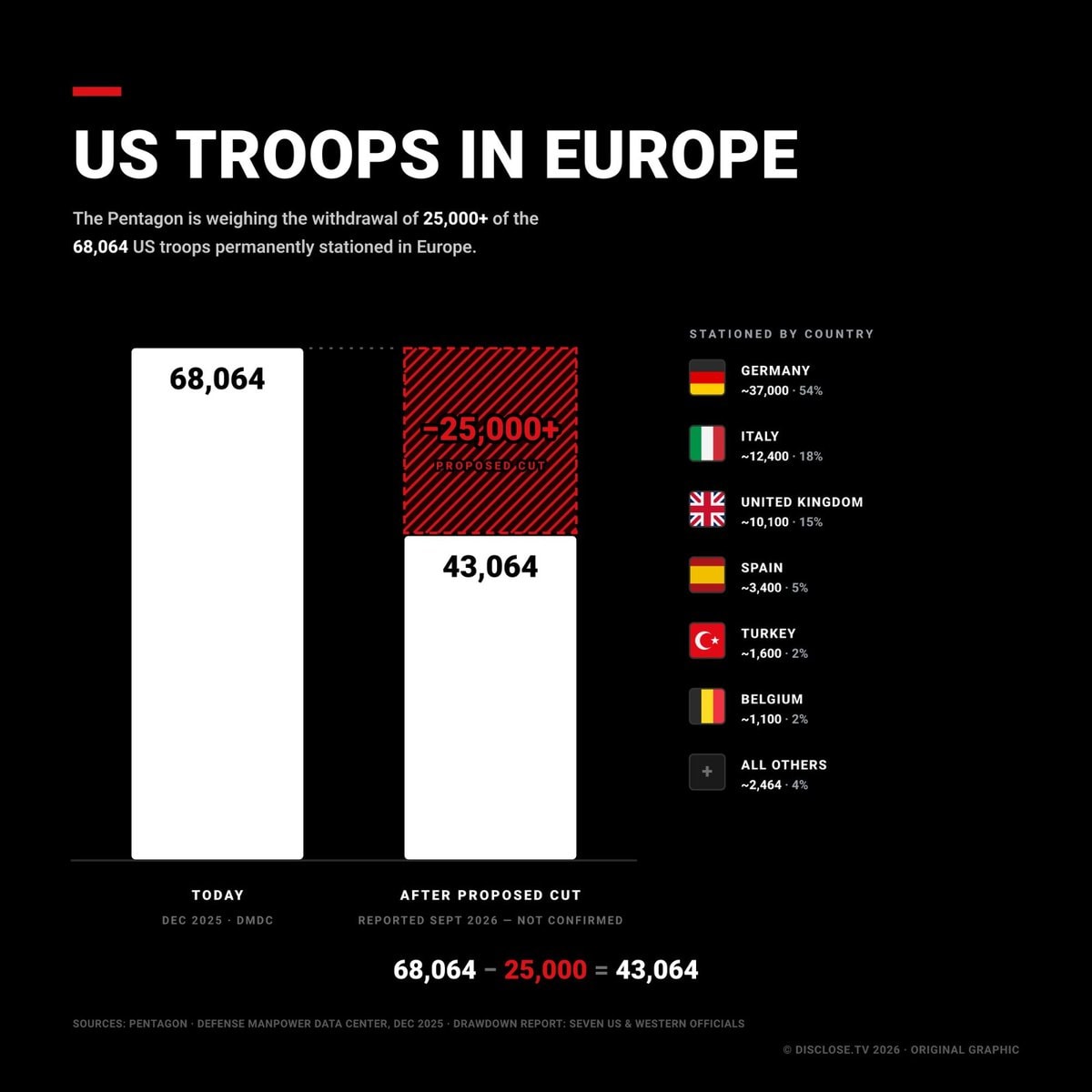 2US Troops in Europe proposed cuts
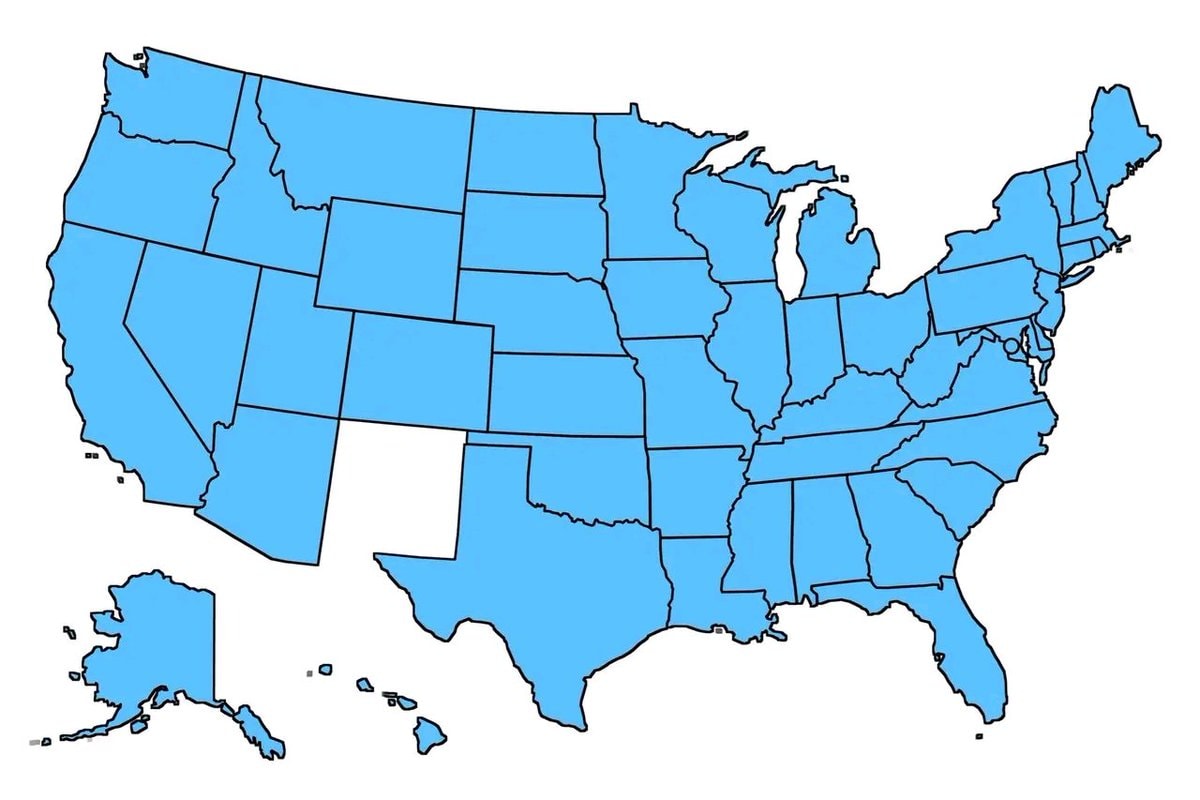 United States old states map
 most common US road suffixes by county
 United States at night
@taikiThere is a confirmed statistic on the percentage of Americans who rely on automobiles for their commute to work
Ver publicación originalFoto de @taiki· Sep 2, 2026· United States
The image is a choropleth map of the United States showing the percent of Americans who depend on cars to get to work. Different colors represent different percentages, with a legend provided at the bottom left. The map highlights specific counties with very high or very low car dependency. The mood is informative and data-driven, with a clean, graphic style. Visually notable are the color gradients and the inset maps zooming in on specific regions like the San Francisco Bay Area and the New York City metropolitan area. ON-SCREEN TEXT: Percent of Americans who depend on cars to get to work Percent of workers over 16 who drove/carpooled to work, 2017-2021 0 50 60 70 80 90 95 100 Source: U.S. Census Bureau (2017-2021) 8 Counties over 98 1. Stewart County, GA, 99.6% 2. Treutlen County, GA,
Aún no hay comentarios. ¡Sé el primero!
Delicate Arch moon frame2US gas station price signs hitting $9.999 limitBlack ethnicity by US countyChina US Treasury holdings 18-year lowBlack Population US 1900 vs 2020Trump AI Force emblemwhite ethnic groups by U.S. county2Trump serious expressionTrump announces AI Force2Trump on midterm election outcomesDonald Trump Greenland Deal1972 US presidential election map2Toys R Us store expansion2US Republicans foreign piracy site ban bill2US Troops in Europe proposed cutsUnited States old states mapmost common US road suffixes by countyUnited States at night
Aún no hay comentarios. ¡Sé el primero!