
@taikiThere is a confirmed statistic on the percentage of Americans who rely on automobiles for their commute to work
Ver publicación original@taikiThere is a confirmed statistic on the percentage of Americans who rely on automobiles for their commute to work
Ver publicación originalFoto de @taiki· Sep 2, 2026· United States
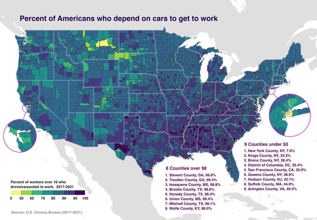
The image is a choropleth map of the United States showing the percent of Americans who depend on cars to get to work. Different colors represent different percentages, with a legend provided at the bottom left. The map highlights specific counties with very high or very low car dependency. The mood is informative and data-driven, with a clean, graphic style. Visually notable are the color gradients and the inset maps zooming in on specific regions like the San Francisco Bay Area and the New York City metropolitan area. ON-SCREEN TEXT: Percent of Americans who depend on cars to get to work Percent of workers over 16 who drove/carpooled to work, 2017-2021 0 50 60 70 80 90 95 100 Source: U.S. Census Bureau (2017-2021) 8 Counties over 98 1. Stewart County, GA, 99.6% 2. Treutlen County, GA,
 Hungary county map with coats of arms
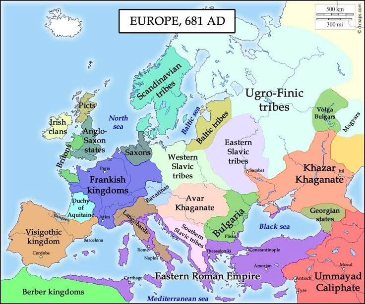 Europe in 681
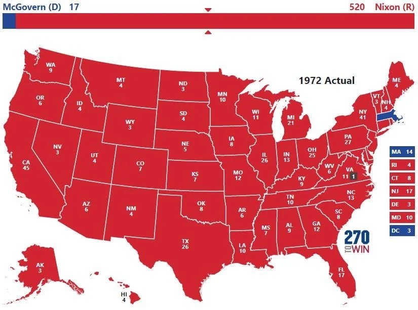 1972 US presidential election map
 Second most spoken language in Mexico
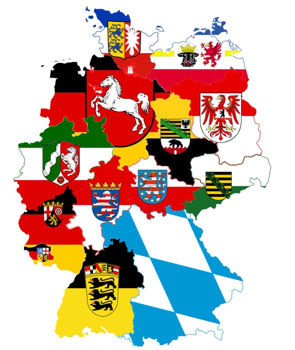 germany sixteen states
 United States at night
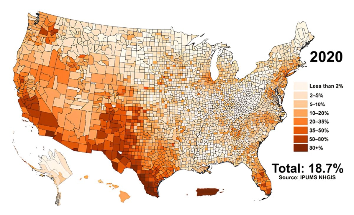 Hispanic population share by U.S. county
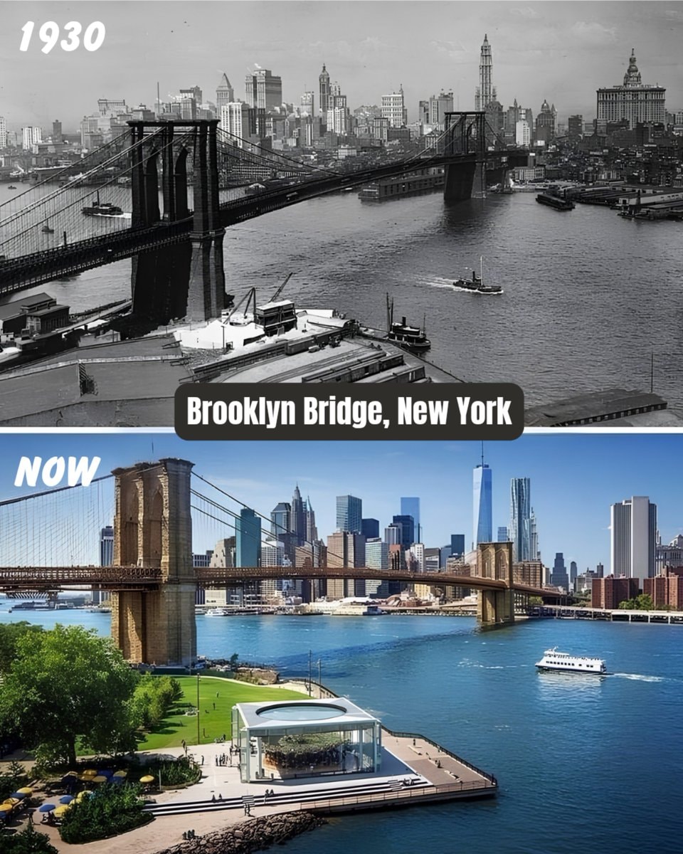 Brooklyn Bridge New York 1930 vs Now
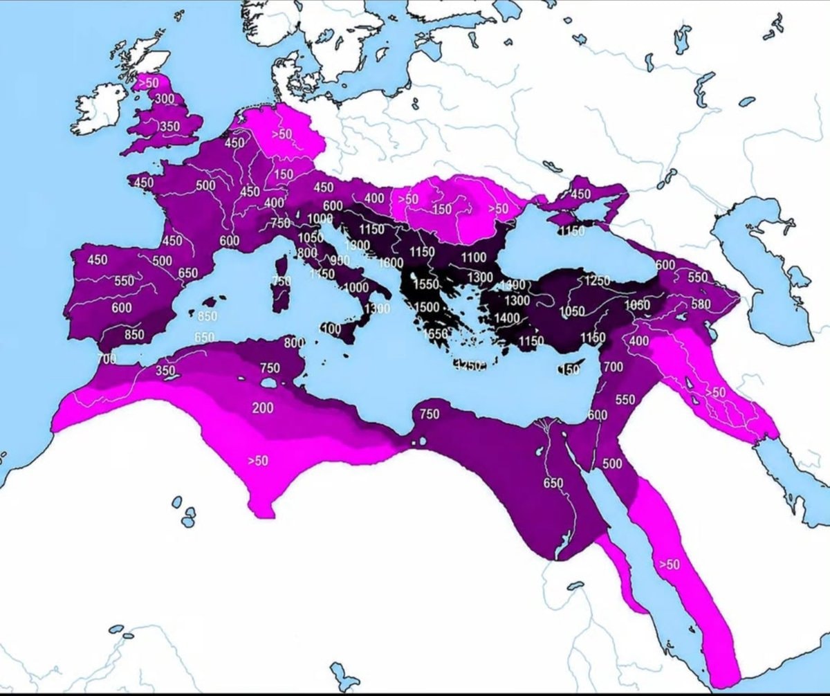 Roman Empire years of control by region
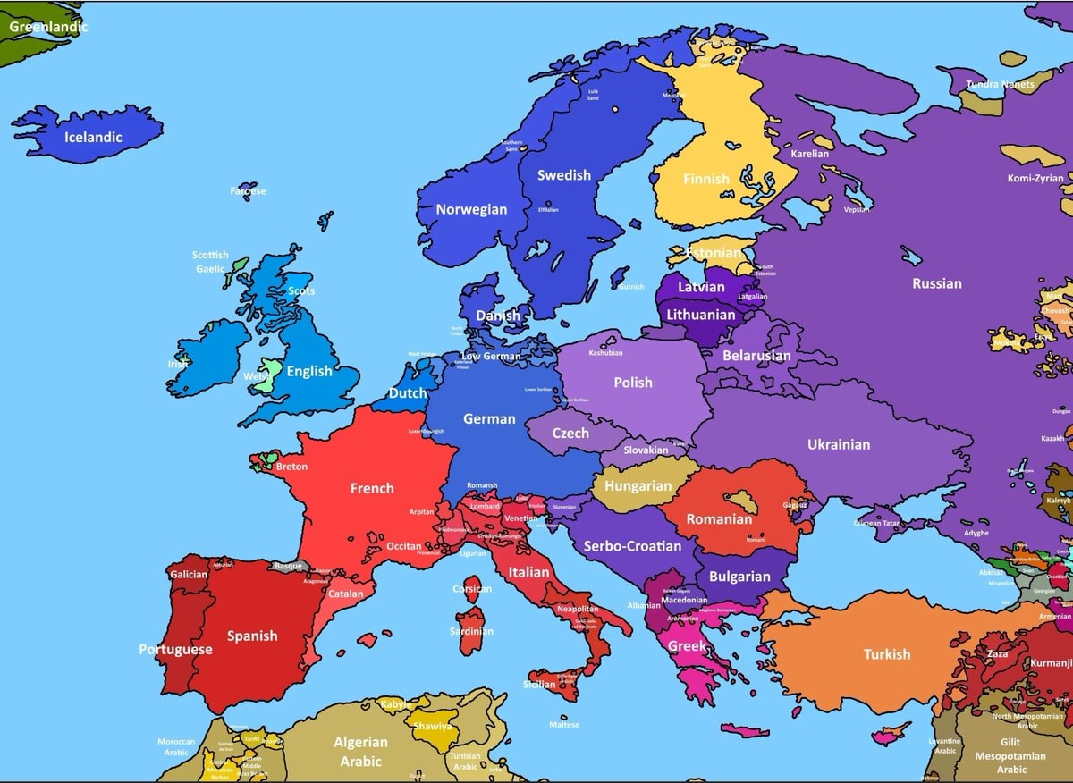 European language map by spoken usage
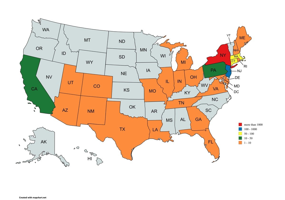 9/11 victims by home state
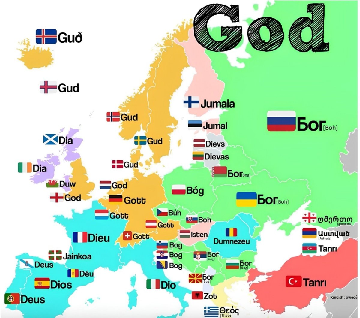 God translations by European region
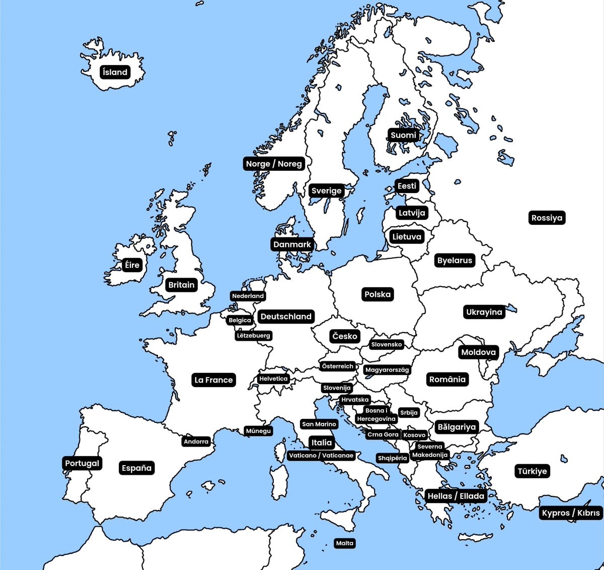 European country native names
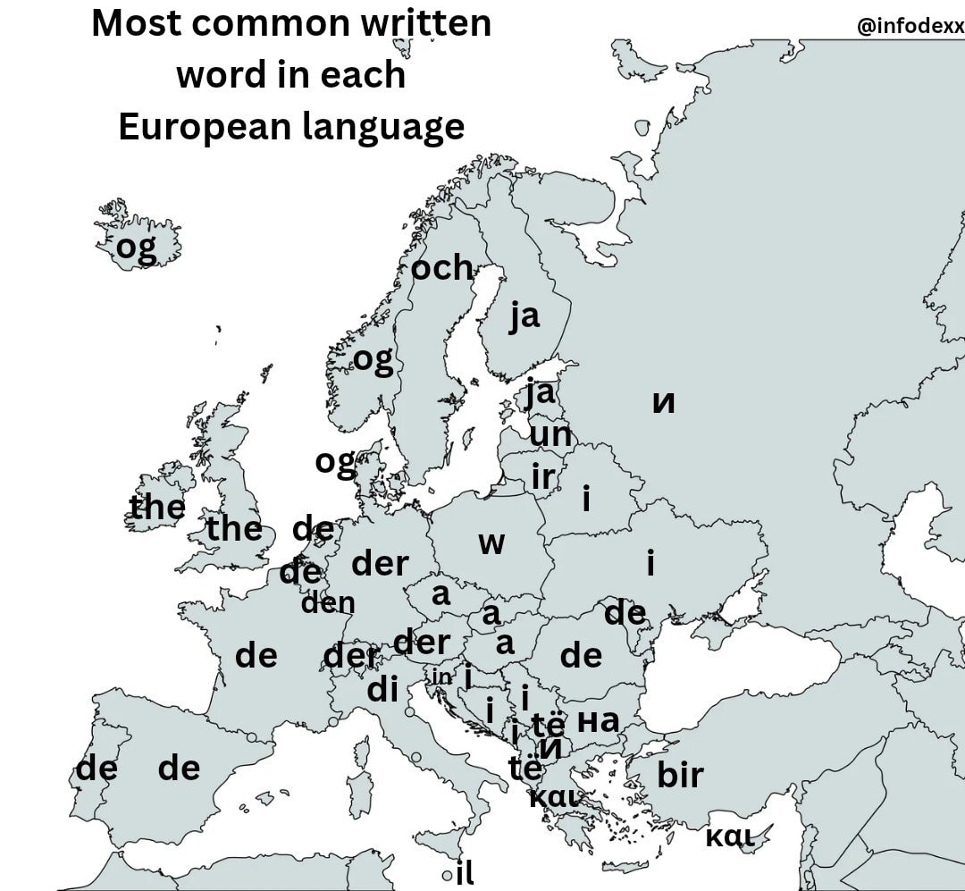 most common written word by european language
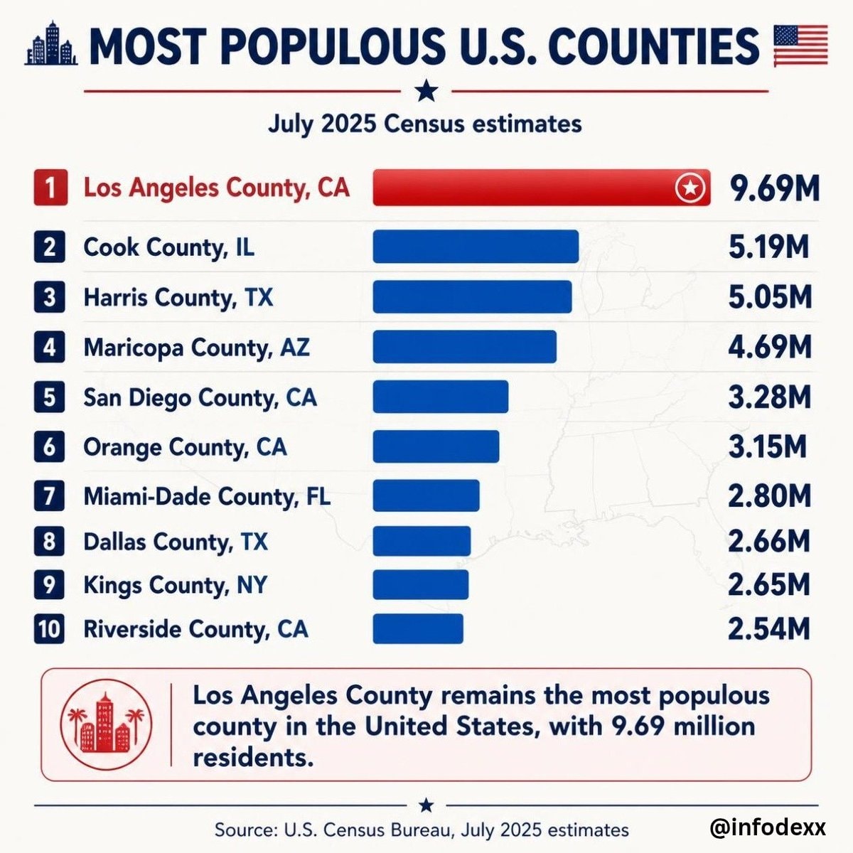 Most populous U.S. Counties
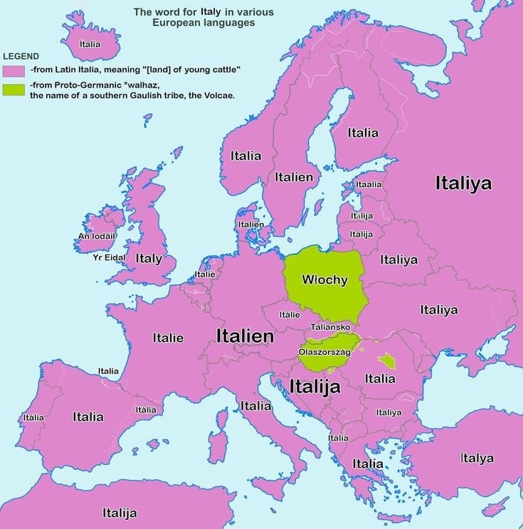 Map of how Europe says Italy
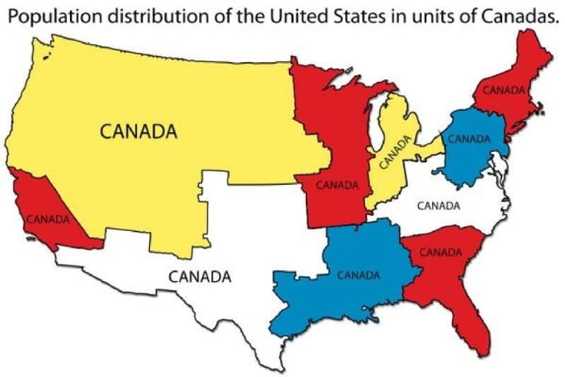 U.S. Population Units of Canada
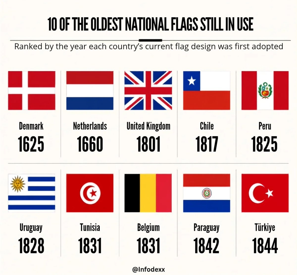 oldest national flags in use
@taikiThere is a confirmed statistic on the percentage of Americans who rely on automobiles for their commute to work
Ver publicación originalFoto de @taiki· Sep 2, 2026· United States
The image is a choropleth map of the United States showing the percent of Americans who depend on cars to get to work. Different colors represent different percentages, with a legend provided at the bottom left. The map highlights specific counties with very high or very low car dependency. The mood is informative and data-driven, with a clean, graphic style. Visually notable are the color gradients and the inset maps zooming in on specific regions like the San Francisco Bay Area and the New York City metropolitan area. ON-SCREEN TEXT: Percent of Americans who depend on cars to get to work Percent of workers over 16 who drove/carpooled to work, 2017-2021 0 50 60 70 80 90 95 100 Source: U.S. Census Bureau (2017-2021) 8 Counties over 98 1. Stewart County, GA, 99.6% 2. Treutlen County, GA,
Aún no hay comentarios. ¡Sé el primero!
Hungary county map with coats of armsEurope in 6811972 US presidential election mapSecond most spoken language in Mexicogermany sixteen statesUnited States at nightHispanic population share by U.S. countyBrooklyn Bridge New York 1930 vs NowRoman Empire years of control by regionEuropean language map by spoken usage9/11 victims by home stateGod translations by European regionEuropean country native namesmost common written word by european languageMost populous U.S. CountiesMap of how Europe says ItalyU.S. Population Units of Canadaoldest national flags in use
Aún no hay comentarios. ¡Sé el primero!